 Shredlytics
Click a trail, lift or lodge for its status, today's conditions and reviews. Hold ⌘ or Ctrl to zoom with the scroll wheel.
Terrain
- 3 easiest
- 7 more difficult
- 4 most difficult
- 1 experts only
Named trails on our map of the mountain, by the sign on the resort's own map.
Elevation
Base 689 ft to summit 1,181 ft, on the same scale as every resort in the list (16–13,487 ft).
Uphill travel
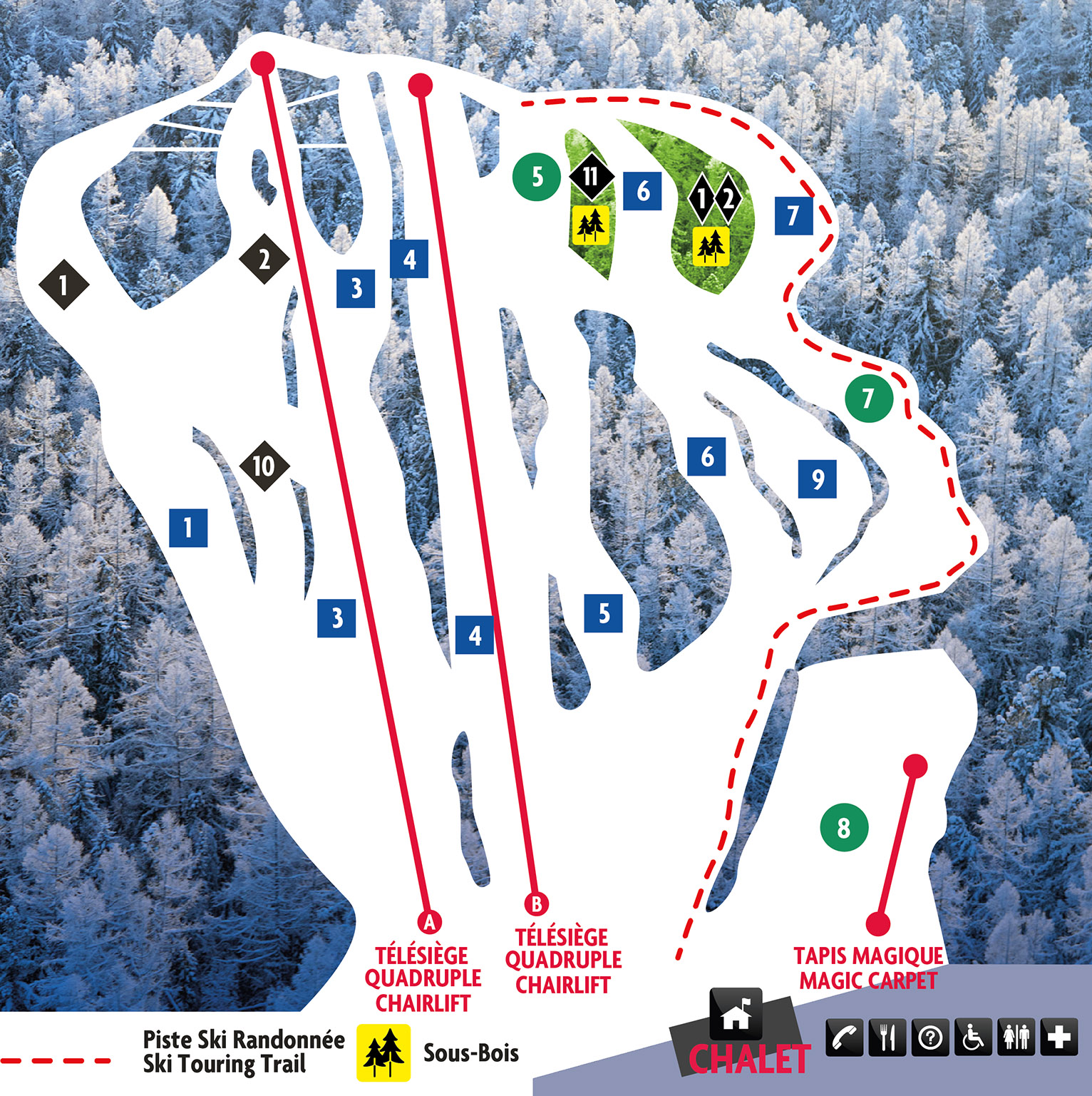
Alpine touring with a valid access ticket or season pass (ticket office or customer service), during the area's operating hours. Climb only on the marked touring route up La Cabane (see the trail map), in single file and visible; never down the route; no closed trails or trails being groomed or snowmade; no dogs, fat bikes or snowshoes. The route is patrolled.
At a glance
- Lifts
- 2 chairs, 1 carpet
- Night skiing
- Yes — Thursday and Friday to 10 p.m., Saturday and Sunday to 10 p.m.
- Trail map
- The resort's official map
- Tickets
- Tickets & passes
- Phone
- 450 227-2637
- Address
- 12, chemin des Skieurs, Saint-Sauveur (Québec) J0R 1R2
Compare with a neighbor
- Sommet Saint-Sauveur2 mi · 700 ft
- Sommet Gabriel3 mi · 516 ft
- Sommet Olympia4 mi · 660 ft
- Sommet Morin Heights5 mi · 630 ft
Lifts and trails
Loading the latest from the resort…
Trail and lift data © OpenStreetMap contributors, via OpenSkiData (ODbL), with additional information from resort sources. Resort facts include information from resort and pass-provider sources. Catalog built 2026-11-01. Trail and lift counts reflect our catalog and may differ from resort totals. Check official resort sources for current closures, access and pass terms. Something wrong? Tell us.