 Shredlytics
Click a trail, lift or lodge for its status, today's conditions and reviews. Hold ⌘ or Ctrl to zoom with the scroll wheel.
Terrain
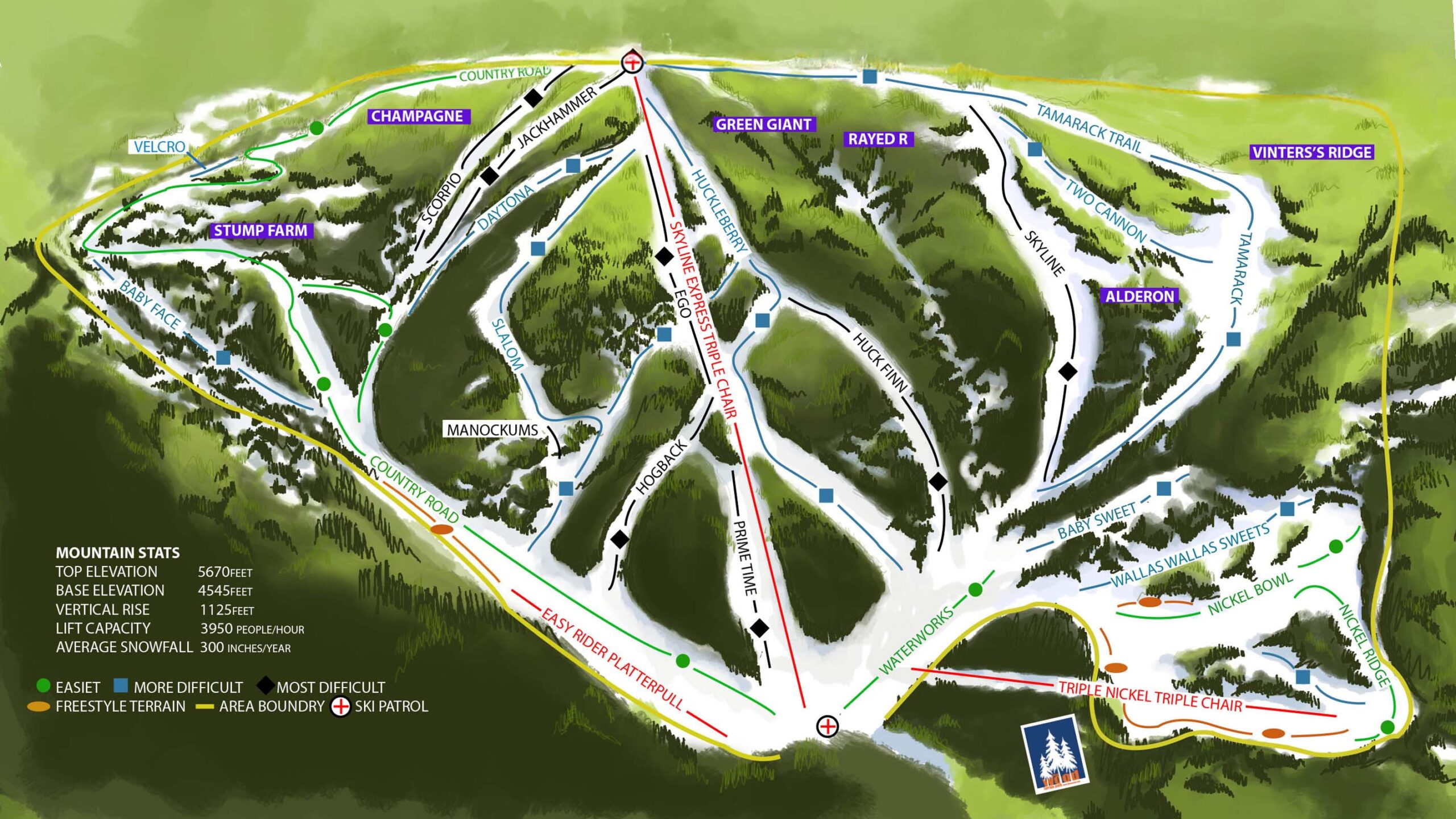
- 5 easiest
- 10 more difficult
- 17 most difficult
- 1 freestyle
Named trails on our map of the mountain, by the sign on the resort's own map. The resort's own mix: 25% beginner · 50% intermediate · 25% advanced.
Elevation
Base 4,545 ft to summit 5,670 ft, on the same scale as every resort in the list (16–13,487 ft).
Uphill travel
No designated uphill route yet — the resort is "working on an uphill route" for 7–9 AM and occasional night skinning events.
At a glance
- Lifts
- 2 chairs, 1 surface lift
- Skiable acres
- 400
- Night skiing
- No (announced on the upgrades page, not yet running)
- Passes
- Indy+ Pass · 2 days
- Indy Base Pass · 2 days
- Trail map
- The resort's official map
- Tickets
- Tickets & passes
- Phone
- (509) 382-4725
- Ski patrol
- (509) 380-4601
- Address
- 2000 N. Touchet Rd., Dayton, WA 99328
Compare with a neighbor
- Ferguson Ridge Ski Area66 mi · 640 ft
- Cottonwood Butte Ski Area67 mi · 845 ft
- Anthony Lakes Mountain Resort79 mi · 900 ft
- Snowhaven86 mi · 370 ft
Lifts and trails
Loading the latest from the resort…
Trail and lift data © OpenStreetMap contributors, via OpenSkiData (ODbL), with additional information from resort sources. Resort facts include information from resort and pass-provider sources. Catalog built 2026-11-01. Trail and lift counts reflect our catalog and may differ from resort totals. Check official resort sources for current closures, access and pass terms. Something wrong? Tell us.